24-HOUR PUBLIC WEATHER FORECAST
Issued at 4:00 AM, 26 July 2024
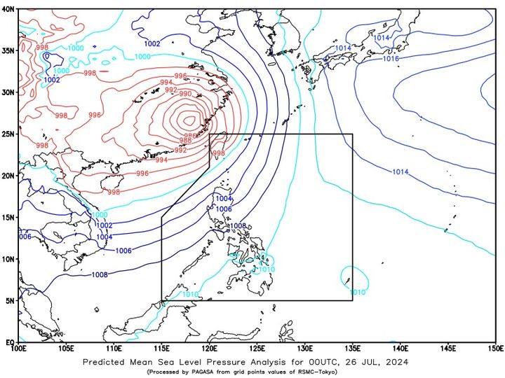
SYNOPSIS: At 3:00 AM today, the Low Pressure Area (LPA) was estimated based on all available data at 1,035 km East of Southeastern Mindanao (6.3°N, 135.0°E). Southwest Monsoon affecting the Luzon and Visayas.
ACTIVE TROPICAL CYCLONE OUTSIDE PAR AS OF 3:00 AM TODAY SEVERE TROPICAL CTORM GAEMI {2403} (FORMERLY “CARINA”) LOCATION: 615 KM NORTH NORTHWEST OF ITBAYAT, BATANES (25.5N, 118.7E) MAXIMUM SUSTAINED WINDS: 95 KM/H GUSTINESS: UP TO 160 KM/H MOVEMENT: WESTWARD AT 15 KM/H
Forecast Weather Conditions
Area: Metro Manila and the rest of Luzon
Weather Condition: Cloudy skies with scattered rains and thunderstorms
Caused By: Southwest Monsoon
Impacts: Possible flash floods or landslides due to moderate to at times heavy rains
Keep monitoring for updates.